Yes, sargassum seaweed reaches Puerto Rico, and 2026 has been a major year for it across the Caribbean. The University of South Florida, which runs the satellite system that tracks the Great Atlantic Sargassum Belt, projected 2026 as a major and possibly record sargassum year, and by mid-year some Caribbean measures were setting new highs. Here is the part most anxious "is there seaweed in Puerto Rico" searches never get told, though: it does not hit the whole island evenly. The east and southeast coasts get the worst of it, the west and north-shore metro beaches usually stay clearer, and the heavy season runs roughly April through October. A trip between November and March is the most reliable way to sidestep it entirely.
What sargassum actually is, and why it matters
Sargassum is a brown seaweed that floats in the open Atlantic in enormous drifting mats. Out at sea it is not a problem at all; it is a natural, living habitat for turtles, crabs, and fish, and small amounts washing up are part of a healthy shoreline. The trouble starts when it arrives in bulk. Thick mats pile up on the sand, turn the near-shore water a murky brown, and then begin to rot. As it decomposes, sargassum releases hydrogen sulfide, the gas responsible for that unmistakable rotten-egg smell, along with ammonia. In large, actively decomposing quantities that gas can irritate the eyes, the skin, and the airways, which is why NOAA and Caribbean health researchers treat heavy beach inundation as a genuine nuisance rather than just an aesthetic one.
For a traveler, the practical translation is simpler. A light scattering of seaweed on the sand is normal and nothing to plan around. A beach buried under a knee-deep, days-old brown mat is not one you will want to swim, snorkel, or sunbathe on, and the smell alone can carry to the beachfront hotels behind it. That is the scenario this guide is built to help you avoid, and the good news is that Puerto Rico's geography gives you real options.
Browse 30 vetted Puerto Rico experiences
Instant confirmation, free cancellation up to 24h.
Why the east coast gets hit and the west coast usually doesn't
The sargassum reaching the Caribbean rides in from the eastern Atlantic on ocean currents, arriving from the east and southeast. That single fact explains most of what you need to know about where it lands in Puerto Rico. Shorelines that face the incoming belt catch it first and hold it longest; shorelines tucked on the far side of the island, or sheltered inside coves and behind reefs, tend to escape the worst.
In practice, that makes the east and southeast coasts the most exposed. The stretch around Fajardo, Ceiba, Humacao, Naguabo, and Yabucoa sees the heaviest and most frequent landings, and Palmas del Mar's Candelero Beach has drawn enough accumulation to trigger organized cleanup and NOAA response work. The south coast is variable and can get significant landings too. The north coast, including the San Juan metro beaches, usually fares better because it does not face the belt head-on, though it is not immune and gets episodic landings of its own. The west coast, from Rincon up through Aguadilla and down to Cabo Rojo, is generally the clearest part of the island because it sits on the sheltered, Caribbean-facing side away from the Atlantic transport path.
None of this is a guarantee. Wind and local currents can drop seaweed on a "safe" beach for a few days and clear a "bad" one just as fast. But as a planning rule, weighting your beach days toward the west and the north shore in sargassum season stacks the odds heavily in your favor.
Where to point a beach day when seaweed is a risk
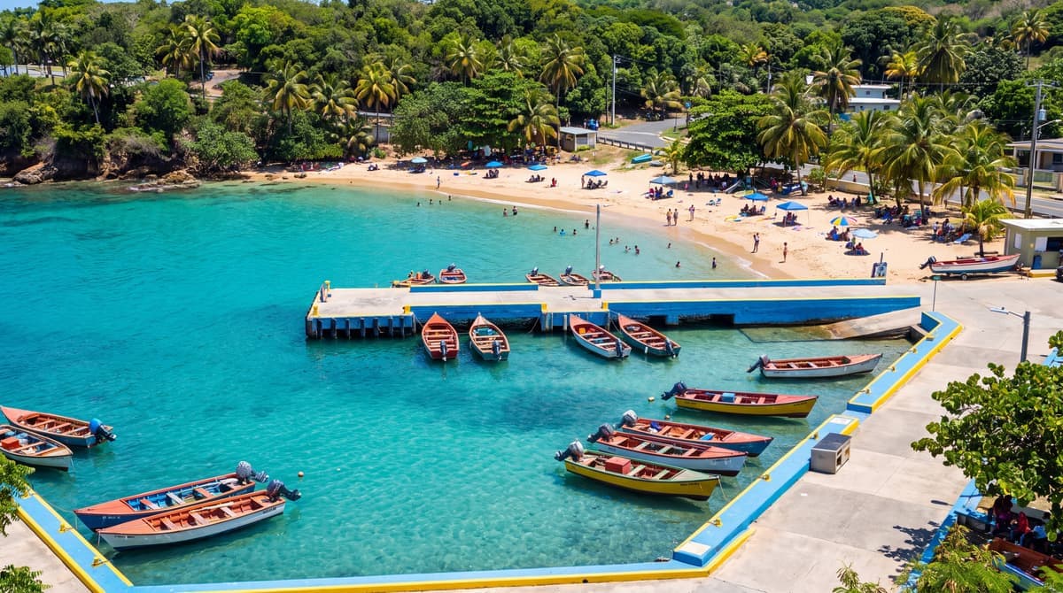
If clean, swimmable water is the priority and you are traveling in the April-to-October window, the west coast is the safest bet. Crash Boat Beach in Aguadilla is a calm, colorful cove that tends to stay clear, and the Rincon beaches nearby are the island's classic clear-water west-coast stretch. The honest caveat: the west coast is a two-and-a-half to three hour drive from San Juan, so it is a base-your-trip-there decision, not a day trip, and because it is the surf coast, winter can bring big swells even when the water is seaweed-free. Cabo Rojo's Playa Sucia on the far southwest tip is another clear-water option if you are already exploring that corner.
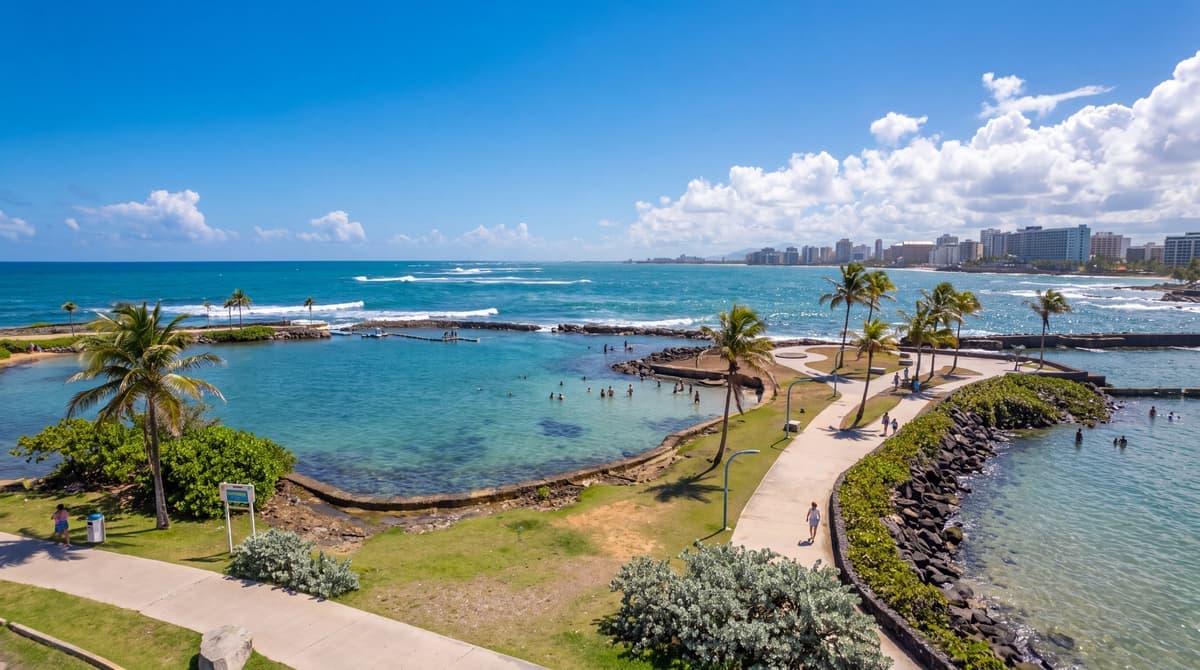
On the north shore, the San Juan metro beaches are the practical clear-water choice for a city-based trip. Condado, Ocean Park, and Isla Verde usually stay clearer than anything on the east coast and put you steps from where most visitors are already staying. The honest caveat here is not sargassum but water safety: these are open Atlantic beaches where rip currents, not seaweed, are the thing to respect, so read the flags and swim near a guarded section. Basing yourself in San Juan also keeps you close to the airport and the widest range of restaurants and tours, which matters more than a beach day for a lot of trips.
The east coast is where you need to plan with your eyes open. Luquillo Beach and the Fajardo area are gorgeous and genuinely worth visiting, but they are the most sargassum-prone corner of the main island, so we would not bank a summer beach day on them without checking conditions first. The trade-off is that this is also where El Yunque, the bio bays, and the Culebra and Vieques ferries are, so you will very likely spend time out east regardless. Just treat the rainforest, a bio bay night, or a boat tour as the anchor of an east-coast day, and let the beach be a bonus if the water is clear rather than the whole plan.
Want your whole trip planned for you?
Tell us who is coming and when, and we will build your days around what you actually want.
Culebra, Vieques, and the island beaches
The offshore islands follow the same logic. On Culebra, Flamenco Beach is regularly ranked among the most beautiful beaches anywhere, and because of its north-facing, horseshoe-shaped bay it is often one of the clearer options even in a heavy year. "Often" is doing real work in that sentence, though: Flamenco does get episodic sargassum, sometimes badly, and conditions there can change morning to afternoon, so it is worth checking before you commit to the ferry and the day it takes to get there. On Vieques, south-facing beaches like Sun Bay and Playa La Chiva can be more exposed depending on the week, though the island's protected pockets are also some of the calmest water in Puerto Rico when the seaweed cooperates.
For snorkeling specifically, sargassum matters more than for a simple swim, because murky brown water kills the visibility that makes a reef worth the trip. If an underwater day is the goal, checking conditions the day before and staying flexible about which spot you choose pays off more here than almost anywhere else.
The free 7-day itinerary
The exact 7 days we send friends
One email with our day-by-day Puerto Rico plan: which beach on which day, where to eat, and the tours worth booking. No spam, unsubscribe anytime.
The seasonal shortcut: when to go to skip it
The single most reliable way to avoid sargassum is timing. Beaching season in the Caribbean runs roughly April through October, building toward a summer peak, and it is not uncommon to see the first significant arrivals as early as April. The lowest-risk stretch is roughly November through March, when the belt is smaller and the water is typically at its clearest.
That window lines up neatly with the rest of Puerto Rico's calendar, which is one of the quiet arguments for a winter trip. The November-to-March low-sargassum season overlaps the island's dry, peak tourist season and sits well outside the September peak of hurricane season. You pay for that in higher prices and bigger crowds, the honest trade-off covered in our guide to when to visit. Summer travelers get lower prices and thinner crowds, but they are trading into both the sargassum peak and the more active stretch of hurricane season, so it is a real decision rather than a free lunch either way. If your dates are locked into summer, lean west and north with your beach days and keep the plan flexible.
Let us plan this trip for you
We check every spot against live sources, share your dates and we'll build the rest.
How to check live conditions before you go
Because a beach can change within hours, the only honest way to know what you will actually find is to check current conditions close to your travel dates. A few tools do this well, and none of them cost anything.
The most useful for Puerto Rico specifically is CARICOOS, the Caribbean Coastal Ocean Observing System, at caricoos.org. It publishes a 7-day near-coastal Sargassum Inundation Forecast with grids broken out for Puerto Rico's regions, including the northeast, the east, San Juan Bay, La Parguera, and Vieques, so you can look at the exact stretch of coast you are headed to rather than the whole Caribbean. For the big-picture Atlantic outlook, the University of South Florida Sargassum Watch System publishes satellite-based bulletins on how much seaweed is in the belt and where it is drifting, and NOAA issues its own sargassum inundation reporting. Beyond the official tools, active Puerto Rico travel groups on Facebook post near-daily beach photos, and many beachfront hotels will tell you honestly what the sand looks like that week if you ask.
One caveat on all of it: satellite monitoring measures floating seaweed in the open ocean and gives you a regional probability, not a beach-level guarantee. Actual conditions on a given morning come down to local wind and current and can flip fast. Use the forecasts to weight your odds and pick your region, then stay a little flexible about exactly which beach you hit on which day.
How we would plan around it
Put simply: if you can travel between November and March, sargassum barely needs to factor into your planning at all, and you dodge the worst of hurricane season in the bargain. If you are traveling in the April-to-October window, base yourself where the odds are good, the west coast for a beach-first trip or San Juan's north shore for a city-first one, treat the east coast as a rainforest-and-bio-bay zone rather than a guaranteed beach day, and check CARICOOS a few days out. Build your beach days into a broader plan, using our 7-day itinerary or the full beaches guide, so that a single seaweedy morning never sinks the whole trip. Sargassum is a real and growing part of Caribbean travel, but in Puerto Rico it is a planning problem with clear answers, not a reason to stay home.
Find your hotel by area & budget
Compare current Puerto Rico rates across the major booking sites in one place, in USD. Most rooms are free to cancel.
FAQ
Is there sargassum in Puerto Rico right now? Conditions change day to day and even hour to hour, so the only reliable answer is a live one. Check the CARICOOS 7-day near-coastal forecast at caricoos.org for your specific region, plus recent photos in Puerto Rico travel groups. As a season, the heavy months run roughly April through October.
Which Puerto Rico beaches have the least sargassum? The west coast is usually the clearest, including Crash Boat Beach in Aguadilla, the Rincon beaches, and Cabo Rojo's Playa Sucia. On the north shore, the San Juan metro beaches at Condado, Ocean Park, and Isla Verde generally stay clearer than anything on the east coast. None of them are guaranteed clear, but the odds are far better than on the east and southeast coasts.
What months is sargassum worst in Puerto Rico? Roughly April through October, building toward a summer peak, with the first significant arrivals sometimes as early as April. The lowest-risk window is roughly November through March, which also happens to fall outside the September peak of hurricane season.
Is sargassum dangerous, and can you swim in it? Floating out at sea it is harmless and a natural habitat. The problem is thick piles decomposing on shore, which release hydrogen sulfide (the rotten-egg smell) and ammonia and can irritate the eyes, skin, and airways in large amounts. A brief brush with a little seaweed in the water is not toxic, but you will not want to swim through, or breathe next to, a big rotting mat.
Does sargassum affect Flamenco Beach and Culebra? Flamenco's north-facing bay makes it one of the clearer options even in a heavy year, but it is not immune and does get episodic sargassum, sometimes badly. Because getting to Culebra takes a ferry and most of a day, check current conditions before you commit.
How do I check sargassum conditions before my trip? Use the CARICOOS 7-day near-coastal Sargassum Inundation Forecast at caricoos.org for Puerto Rico-specific grids, the University of South Florida Sargassum Watch System for the Atlantic-wide outlook, and NOAA's sargassum reporting. Local Facebook travel groups and a direct question to your hotel fill in the day-to-day, beach-level picture the satellites cannot.